
GOES-15 visible and shortwave IR images (click image to play animation)
A brief pyrocb event was seen on GOES-15 imagery on August 12, 2013. A two-panel comparison of GOES-15 visible and shortwave IR images (above; click image to play animation) showed numerous hot spots (red enhancement on shortwave IR) at latitude/longitude of 43.8 degrees North and 114.5 degrees West. On the visible images, there was also evidence of a pyrocb anvil. Hot spots were not apparent on the following day.
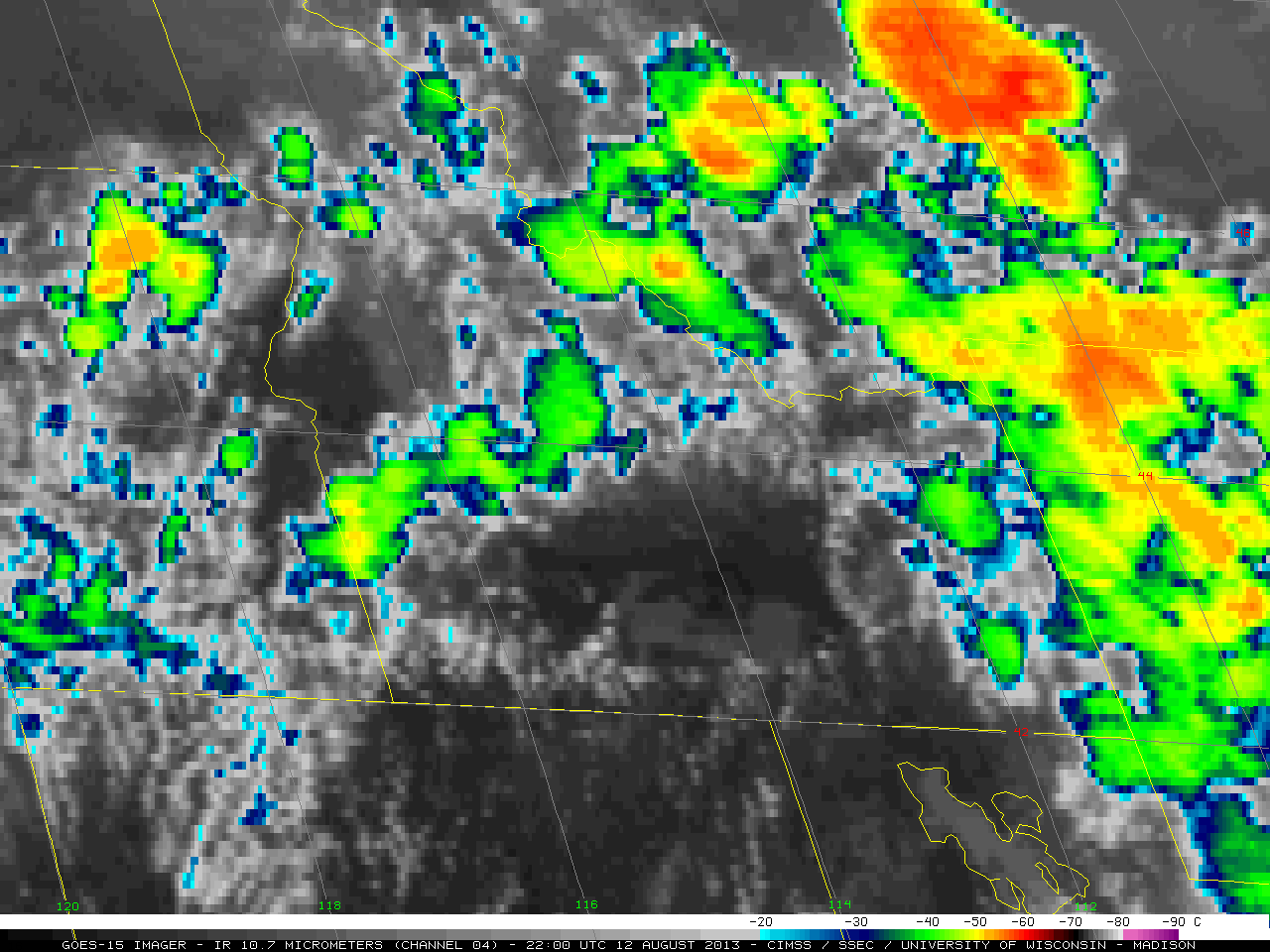
GOES-15 IR image (click to play animation)
On the GOES-15 IR images (above; click to play animation), the cloud top temperatures of -40 degrees Celsius or colder (green enhancement) were evident, which indicates that the cloud tops were glaciated.
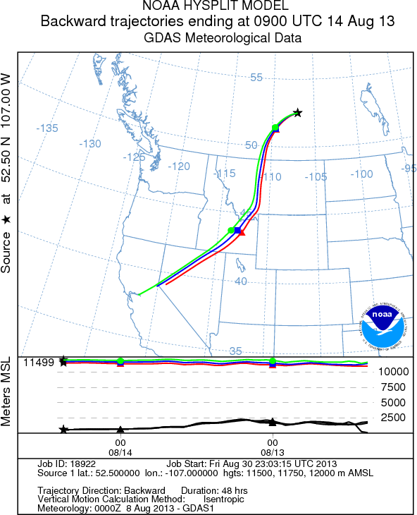
Backward Air mass Trajectories
According to CALIPSO lidar data, the smoke was injected to an altitude of around 10 km and was transported northeastward into Canada.