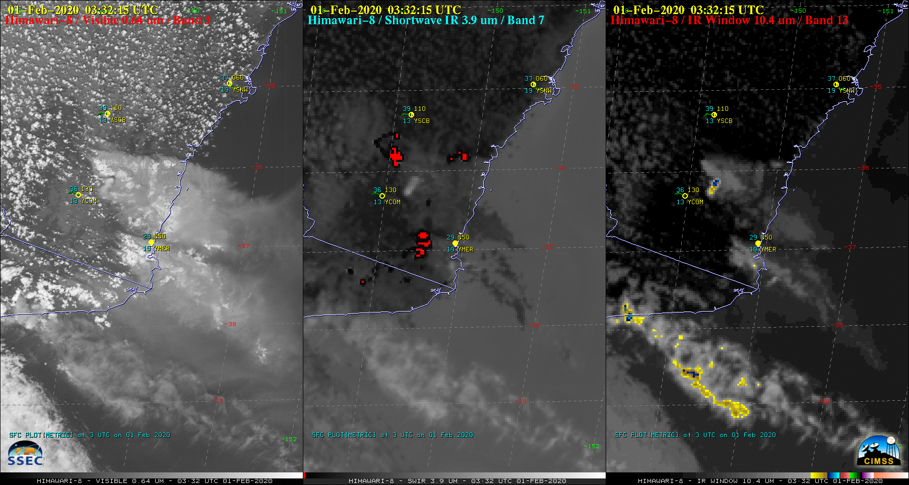
Himawari-8 “Red” Visible (0.64 µm, left), Shortwave Infrared (3.9 µm, center) and Infrared Window (10.4 µm, right) images [click to play animation | MP4]
NOAA-20 VIIRS True Color Red-Green-Blue (RGB) and Infrared Window (11.45 µm) images at 0426 UTC as viewed using RealEarth (below) revealed cloud-top infrared brightness temperatures near -60ºC (darker red enhancement).
![NOAA-20 VIIRS True Color RGB and Infrared Window (11.45 µm) images at 042 UTC [click to enlarge]](https://cimss.ssec.wisc.edu/satellite-blog/images/2020/02/200201_0426utc_noaa20_viirs_trueColorRGB_infraredWindow_Australia_pyrocb_anim.gif)
NOAA-20 VIIRS True Color RGB and Infrared Window (11.45 µm) images at 0426 UTC [click to enlarge]
![Suomi NPP VIIRS Day/Night Band (0.7 µm) and Shortwave Infrared (3.74 µm) images at 1454 UTC [click to enlarge]](https://cimss.ssec.wisc.edu/satellite-blog/images/2020/02/200201_1454utc_suomiNPP_viirs_dayNightBand_shortwaveInfrared_Australia_bushfires_anim.gif)
Suomi NPP VIIRS Day/Night Band (0.7 µm) and Shortwave Infrared (3.74 µm) images at 1454 UTC (credit: William Straka, CIMSS) [click to enlarge]
