
MTSAT-2 visible channel images (click image to play animation)
Another possible pyrocumulonimbus (pyroCb) event occurred in the Lake Baikal region of eastern Russia during the 10-11 May 2013 period. MTSAT-2 visible channel images (above; click image to play animation) showed evidence of pyroCb cloud blow-ups, and MTSAT-2 shortwave IR images (below; click image to play animation) revealed clusters of fire activity “hot spots” (dark black pixels).

MTSAT-2 shortwave IR images (click image to play animation)
There appeared to be 2 distinct areas of hot spot flare-ups: one beginning at 07:01 UTC, and another beginning just to the southeast at 08:32 UTC. Comparisons of MTSAT-2 visible and shortwave IR images at 07:32 UTC and 09:01 UTC are shown below.

Comparison of MTSAT-2 visible and shortwave IR channel images at 07:32 UTC

Comparison of MTSAT-2 visible and shortwave IR channel images at 09:01 UTC
MTSAT-2 10.8 µm longwave IR or “IR window” images (below; click image to play animation) indicated that the pyroCb cloud features eventually exhibited IR brightness temperatures of -50 C and colder (orange color enhancement).
")
MTSAT-2 10.8 µm IR channel images (click image to play animation)
The 12 May OMPS Aerosol Index product (below) showed a distinct plume of high aerosol index northwest of Lake Baikal, which then continued to move northward toward the Arctic Ocean (as seen in CALIPSO data, as an elevated layer at an altitude of 9-10 km near 70-75 North latitude on 12 May and near 65-70 North latitude on 13 May).
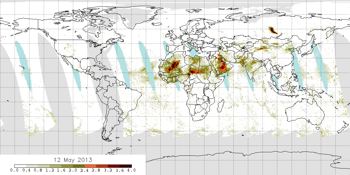
OMPS Aerosol Index
")

")