On July 30, 2014, a lightning strike started the Oregon Gulch Fire, part of the Beaver Complex of fires, becoming an extremely active fire due to the very dry conditions in this part of the country. As these fires grew, another thunderstorm system passed through northern California on August 1, 2014 with over 1,000 lightning strikes recorded; this system started a series of fires in that area that quickly spread with the help of the even drier conditions compared to southern Oregon. These two areas of fires created several pyroCbs starting August 1 to August 3, 2014.
___________________________________________

GOES-15 0.63 µm visible (left) and 3.9 µm shortwave IR (right) images (click to play animation)
On August 1st, 2014 at 02:45 UTC, the Beaver Complex Fire produced a pyroCb just north of the California/Oregon border near Ashland, Oregon. GOES-15 0.63 µm visible channel and 3.9 µm shortwave IR channel images (above; click image to play animation) showed that the pyroCb cloud feature became well-defined starting 02:00 UTC, drifting rapidly northward into a line of thunderstorms. At that time the fire source hot spot (located near 41º North, 122.2º West) exhibited an IR brightness temperature of 338.3 K (red enhancement).
The corresponding GOES-15 10.7 µm IR channel images (below; click to play animation) indicated that the pyroCb cloud feature displayed a minimum IR brightness temperature value of -43.9º C starting 01:00 UTC and quickly grew in height based on the colder temperatures indicated by the IR brightness temperature.

GOES-15 10.7 µm IR images (click to play animation)
During the development of this pyroCb, the 173rd Fighter Wing of the Oregon Air National Guard flew F-15 Eagle fighter jets over the area and captured some incredible pictures of the pyroCb around 02:00 UTC or 8:00pm local time. The GOES-15 visible and shortwave IR image is a still frame taken about the same time as the photos were taken from the cockpit of the F-15 Eagle.

GOES-15 0.63 µm visible (left) and 3.9 µm shortwave IR (right) image at 02:00 UTC on August 1, 2014.

An F-15 Eagles from the 173rd Fighter Wing, Oregon Air National in the foreground of a pyroCb produced from the Beaver Complex Fire. (Photo Credit: Jim “Hazy” Haseltine, HIGH-G Productions)

An F-15 Eagles from the 173rd Fighter Wing, Oregon Air National in the foreground of a pyroCb produced from the Beaver Complex Fire. (Photo Credit: Jim “Hazy” Haseltine, HIGH-G Productions)

An F-15 Eagles from the 173rd Fighter Wing, Oregon Air National in the foreground of a pyroCb produced from the Beaver Complex Fire. (Photo Credit: Jim “Hazy” Haseltine, HIGH-G Productions)
___________________________________________
On Friday August 1, two more pyroCbs manifested in the same region. GOES-15 visible channel and IR channel images (below) show the first pyroCb developed around 23:00 UTC located near 41º North, 121.1º West and the second event around 01:00 UTC on August 2 located near 42º North, 122º West.

GOES-15 0.63 µm visible (left) and 3.9 µm shortwave IR (right) images (click to play animation)
The GOES-15 10.7 µm IR channel images (below; click to play animation, also available as an MP4 move file) during the same time frame as the visible and shortwave IR show that these two pyroCb features display a minimum IR brightness temperature value of -43.9º C at 23:30 UTC located near 41º North, 121.1º West and 01:30 UTC located near 42º North, 122º West.

GOES-15 10.7 µm IR images (click to play animation)
___________________________________________
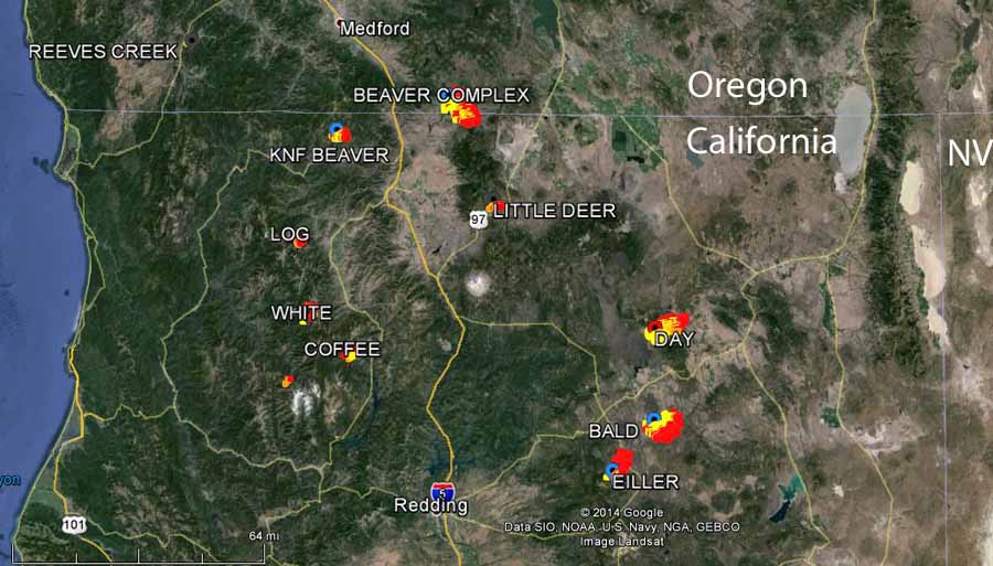
The fires in Northern California and Southern Oregon on August 2, 2014. (Photo Credit: Wildfire Today)

GOES-15 0.63 µm visible (left) and 3.9 µm shortwave IR (right) images (click to play animation)

GOES-15 10.7 µm IR images (click to play animation)
The corresponding GOES-15 10.7 µm IR channel images (above; click to play animation) show the pyroCb cloud features for all five events starting around 21:00 UTC. All these events happened quite rapidly and the GOES-15 10.7 µm IR channel images do an excellent job showing on pyroCb spawning after another after another.
Here is a night-time comparison of AWIPS images of Suomi NPP VIIRS 3.74 µm shortwave IR and 0.7 µm Day/Night Band data (below) at 10:21 UTC (or 3:21 AM local time) on August 3. The shortwave IR image “hot spots” (black to yellow to red enhancement) shows these fires continuing to burn through the night.

Suomi NPP VIIRS 3.74 µm shortwave IR and 0.7 µm Day/Night Band images
1 Comment
Fabulous! Just fabulous! Dare I say the most fabulous article I’ve ever seen! This Britta girl, she’s going places.